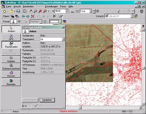

DeltaGIS Map Edition
Version 4.0.6
Commercial Demo
$418.00
2 downloads
Graphical Field Management of GPS Measurements, Import
of ESRI-Shape and GPS files, EU conform Field Protocol
as PDF, True-of-scale Print in free selectable scale;
All Fields in a single farmmap; Edits Fields,
Individual coloring, Field splitting; Recognizes
restricted areas; Calculation of Areas and Distances;
Editoptions for Symbols (e.g. tress, stones), Text and
freehand drawings
Program details
Publisher
Dr. Erhard RegenerE-mail
Contact the publisherHome page
http://www.deltagis.com/Platforms
Windows 95<br>Windows 98<br>Windows ME<br>Windows File size
5703 KBFile date
6/18/2004License
Commercial DemoExpiration info
In the trial version the saving of new enterprise maps is disabled.Installation
Install & UninstallRecord updated
9/17/2004

