|
|
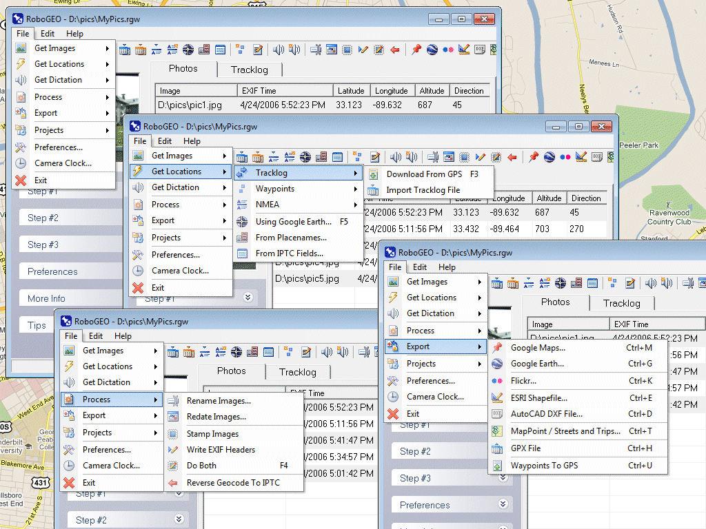
 RoboGEO
-
Version
5.2
RoboGEO
-
Version
5.2
Geocode digital images with latitude, longitude,
altitude, and direction information. RoboGEO stamps
this information onto the actual photo or writes it to
the EXIF headers, allowing you to permanently geotag
and link your photos to the GPS coordinates. All
writing to the EXIF and IPTC headers is lossless and
all of the existing comments (including the MakerNote
and the Adobe XMP metadata) are preserved. Includes a
Picasa-style geotagger for Google Earth. Create web
pages that use Google Maps, export KML or KMZ files to
Google Earth, upload geotagged photos to Flickr,
export ESRI SHP shapefiles, export to MapPoint, or
export DXF files to AutoCAD or IntelliCAD. Show the
photo direction on maps and calculate it from the GPS
tracklog. Automatically merge EXIF or IPTC tags into
the image titles and descriptions. Record dictation
using any modern digital voice recorder and
automatically associate audio with the photos. Rotate
or redate images based on the EXIF info. Export GPX
files. Edit the EXIF times. Lookup altitudes knowing
only lat/lon. Photo locations can be projected to a
|